FAA Bans Drones Along the Entire US-Mexico Border Until October 2027

The FAA is closing the airspace along the entire US-Mexico border to unauthorised drones for a year. The restriction covers everything within one nautical mile (about 1.15 miles) north of the border, from the ground up to 400 feet, from the Pacific to the Gulf of Mexico, and applies to every drone, including recreational drones under 250 g. The Departments of Transportation, War and Homeland Security announced it on 16 October 2026; the FAA’s notice lists it as running from 19 October 2026 to 19 October 2027.
Only flights cleared by US Customs and Border Protection (CBP) are allowed, and the approval categories leave no route for routine commercial or hobby flying. Here is what is covered, who can still fly and how to ask.
Quick answer
| Southern border drone restriction | |
|---|---|
| Announced | 16 October 2026 by DOT, the Department of War and DHS |
| Effective | 19 October 2026 to 19 October 2027 (FAA Domestic Notice) |
| Area | 1 nautical mile north of the entire US-Mexico border, Pacific to Gulf |
| Altitude | Surface to 400 feet |
| Who it covers | All drones, including sub-250 g recreational drones |
| NOTAMs | ZLA 6/9954, ZAB 6/9978, ZHU 6/9956 (per FAA notice) |
| Permission | Email CBP at least 48 hours ahead; emergencies call CBP at 951-570-4185 |
| Penalties | Interception, fines, certificate action, criminal charges; drones may be disabled or destroyed |
What the restriction covers
The FAA split the border into three temporary flight restrictions along the boundaries of its Los Angeles, Albuquerque and Houston air traffic control centres. Together they cover a band one nautical mile deep along the whole southern border, from the surface to 400 feet above ground. DroneXL notes the band takes in the downtowns of border cities such as El Paso, Laredo and Brownsville in Texas, Nogales in Arizona and Calexico in California, so it affects far more than empty desert.
DroneXL reported the airspace is designated National Defense Airspace under 49 U.S.C. 40103(b)(3). As of the afternoon of 16 October, the NOTAMs were not yet showing on the FAA’s TFR list or its UAS Data Delivery System, though the FAA’s Domestic Notice included a map of the full line. Check the NOTAMs and your flight app before any flight near the border, and remember that restrictions published as NOTAMs do not always appear in apps straight away.
Why the government is doing it
The agencies framed the restriction as a response to cartel drones. Transportation Secretary Sean Duffy said the restriction protects the airspace from cartel drone threats. Secretary of War Pete Hegseth said the US “will maintain 100% operational control of our border: land, air, and sea” and that its forces “will shoot down any cartel drone that threatens America’s sovereignty.” Homeland Security Secretary Markwayne Mullin said the action helps counter cartel drone threats and protect personnel.
The numbers behind that concern are large. Joint Task Force-Southern Border detected at least 378 drones in the 30 days to 22 September 2026, and CBP logged 37,000 border drone flights in fiscal year 2026, down from 42,000 the year before, DroneXL reported. We covered the wider counter-drone picture, including the Army laser now downing cartel drones, in who can legally take down a drone in the US.
Who can still fly, and how to ask
Flights inside the band need authorisation from CBP. According to DroneXL’s reading of the NOTAMs, approvable categories are national defence, homeland security, law enforcement, firefighting, medical evacuation, search and rescue, disaster response and “event operations”, which the NOTAMs do not define. There is no category for routine commercial work such as real estate photography or inspections, or for recreational flying.
To request access, the FAA notice says to email [email protected] at least 48 hours before the flight, with:
- operator name, FAA certifications and phone number
- proposed flight date, time and location
- drone details: Remote ID, make, model and serial number
First responders and others handling natural disasters or time-sensitive emergencies may get expedited coordination by calling CBP at 951-570-4185. A Part 107 certificate alone does not let you fly in the band; LAANC authorisations do not override a TFR. If you fly commercially in a border city, plan for jobs that start or sit more than a nautical mile from the border, or apply early and expect a refusal outside the listed categories.
Penalties
The NOTAMs warn that pilots who enter the band may be intercepted, detained and interviewed, fined, lose their FAA certificates or face criminal charges under 49 U.S.C. 46307, DroneXL reported. The government may use deadly force against an aircraft judged an imminent threat, and DoD, DHS or DOJ may interfere with, seize, damage or destroy drones judged a credible threat under 10 U.S.C. 130i and 6 U.S.C. 124n. Civil penalties for drone violations can reach $75,000 per violation under the FAA’s 2024 reauthorisation.
How this compares with earlier restrictions
- August 2025: at DHS’s request the FAA banned drones over about 150 square miles north of Nogales, Arizona, until 9 February 2026, citing special security reasons, AZFamily reported.
- January 2026: NOTAM FDC 6/4375 barred drones near moving federal assets such as convoys; because those zones moved with the assets, flight apps could not display them.
- World Cup 2026: nearly 250 flight restrictions covered host cities, and more than 700 drones were taken out of the sky.
The new restriction is different in scale: one continuous band along roughly 1,950 miles of border, for a full year. DroneXL, which supports border monitoring, criticised the length, the depth of the band and the lack of a Part 107 category.
What drone pilots in border states should do
- Check NOTAMs ZLA 6/9954, ZAB 6/9978 and ZHU 6/9956 and the FAA notice map before flying anywhere near the border.
- Do not rely on a flight app alone in the first days; the restriction may not appear immediately.
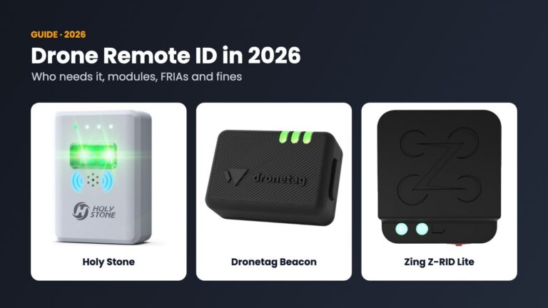
- Keep Remote ID working; it is how authorities identify drones, and CBP asks for your Remote ID in requests. See our Remote ID guide.
- For paid work near the border, request CBP authorisation at least 48 hours ahead and keep the approval with you.
- If you see a suspicious drone near the border, report it to CBP or local police rather than interfering.
Flying legally: Remote ID modules
Holy Stone Remote ID Module
Broadcast module for drones without built-in Remote ID.
Dronetag Beacon Gen 2
16 g module with long battery life.
As an Amazon Associate, Drone Ranker earns from qualifying purchases. We do not quote prices because Amazon’s change by the hour.
Frequently asked questions
Can I fly a drone near the US-Mexico border?
Not within one nautical mile of the border, up to 400 feet, from 19 October 2026 to 19 October 2027, unless US Customs and Border Protection authorises the flight.
Does the border drone ban apply to drones under 250 grams?
Yes. The restriction covers all drones, including recreational drones under 250 g.
How do I get permission to fly in the border drone restriction?
Email [email protected] at least 48 hours ahead with your name, FAA certifications, phone, flight details and drone Remote ID, make, model and serial. Emergencies can call CBP at 951-570-4185.
Can Part 107 pilots fly near the border?
Only with CBP authorisation. The approval categories cover defence, security, law enforcement, firefighting, medevac, search and rescue, disaster response and event operations, with no routine commercial category.
What happens if I fly a drone in the border restriction?
You can be intercepted, detained, fined, lose your FAA certificate or face criminal charges, and authorities may disable or destroy a drone judged a threat.
Why did the FAA ban drones along the southern border?
The agencies cited cartel drone threats; Joint Task Force-Southern Border detected at least 378 drones in 30 days in August and September 2026.
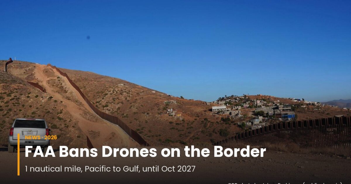
Cover photo: the US-Mexico border wall near San Diego, 18 August 2025. CBP photo by Jaime Rodriguez (public domain).
Product links on this page are Amazon affiliate links. If you buy through them, Drone Ranker may earn a commission at no cost to you. We compare drones from manufacturer specifications and filings, not hands-on flight tests.
Sources
- US DOT: DOT, DoW, DHS join forces to protect southern border airspace (16 October 2026)
- FAA Domestic Notice: US Southern Border TFRs for UAS
- DroneXL: FAA bans drones along entire US-Mexico border until October 2027 (16 October 2026)
- DroneXL: 378 border drone incursions in 30 days (6 October 2026)
- DroneXL: CBP logged 37,000 border drone flights in FY2026 (15 October 2026)
- AZFamily: Feds ground drones near Nogales (28 August 2025)
Sources
Primary references used for factual claims in this article.
The Friday Brief
One email a week on what changed in drones
FCC and FAA rule changes, DJI leaks checked against filings, and the week’s new comparisons. Every Friday, nothing else.
Free. Unsubscribe in one click. Sent with Kit; see our privacy policy.
Follow us on Google too: add Drone Ranker as a preferred source →
Continue Reading
All News