DJI Matrice 400 Specs: Weight, Payload, Flight Time and US Status

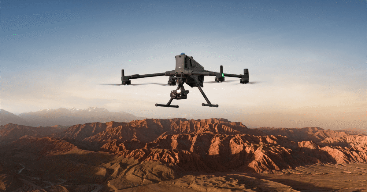
The DJI Matrice 400 is the largest aircraft DJI sells to civilian operators: a 9.7 kg platform that lifts 6 kg of payload, is rated for 59 minutes in the air, uses a rotating LiDAR and millimeter-wave radar for obstacle sensing, and reaches its controller over O4 Enterprise Enhanced at up to 40 km in FCC regions. DJI announced it in June 2026 as the successor to the Matrice 350 RTK.
In the United States it sits in an awkward spot. It was FCC-authorized before the 22 December 2025 Covered List cut-off, so it is legal to buy and fly, but state laws and grant conditions keep it out of many public-safety budgets.
This page is built from DJI’s published specifications and user manual, cross-checked against the FCC equipment authorization database. The aircraft was not flown for it. Figures are DJI’s unless stated otherwise, last verified on 5 October 2026.
Table of Contents
DJI Matrice 400 key specifications
| Specification | DJI Matrice 400 | What it means |
|---|---|---|
| Weight (batteries fitted, no payload) | Approx. 9,740 g | Under the 25 kg class limit in most jurisdictions; travels by vehicle, not backpack |
| Max takeoff weight | 15.8 kg | Leaves roughly 6 kg for payloads |
| Max payload | 6 kg | Enough for a Zenmuse H30T plus a second gimbal, or a delivery/winch module |
| Max flight time | 59 min (DJI test conditions) | Up from 55 min on the Matrice 350 RTK |
| Max speed | 25 m/s (90 km/h) | Same as the Matrice 350 RTK |
| Wind resistance | 12 m/s | A strong breeze, not a gale |
| Service ceiling | 7,000 m | High-altitude survey work possible, with reduced payload |
| Ingress protection | IP55 | Dust-protected and resistant to water jets; degrades with wear |
| Operating temperature | -20 °C to 50 °C | Wider than the Matrice 4 series (-10 to 40 °C) |
| Transmission | O4 Enterprise Enhanced, 40 km FCC / 20 km CE | Cellular backup via the 4G dongle |
| Battery | TB100, 977 Wh (as listed by DJI) | Hot-swappable; the BS100 station charges them |
| Obstacle sensing | Omnidirectional vision, rotating LiDAR (0.5–100 m), millimeter-wave radar | Designed to see power lines and thin branches |
| Positioning | RTK, 1 cm + 1 ppm horizontal | Survey-grade without a ground station when NTRIP is available |
| US availability | FCC ID SS3-M4002412, authorized before the 22 Dec 2025 cut-off | Sold through US enterprise dealers; check state and grant rules |
Source: DJI Matrice 400 specifications page and user manual; FCC equipment authorization database. Compiled 5 October 2026.
Weight, size and build
DJI lists the Matrice 400 at about 9,740 g with its TB100 batteries fitted and no payload, against a 15.8 kg maximum takeoff weight. It is a conventional quadrotor with folding arms and quick-release propellers, and with a payload and spare batteries it travels in a wheeled hard case. The headline is payload: the Matrice 350 RTK carried 2.7 kg, so the Matrice 400 roughly doubles what can hang underneath, which is what makes dual-gimbal and winch setups practical. If your rules use a 25 kg takeoff-weight threshold, as many jurisdictions do, a fully loaded Matrice 400 stays well under it, but check your own aviation authority’s rules.
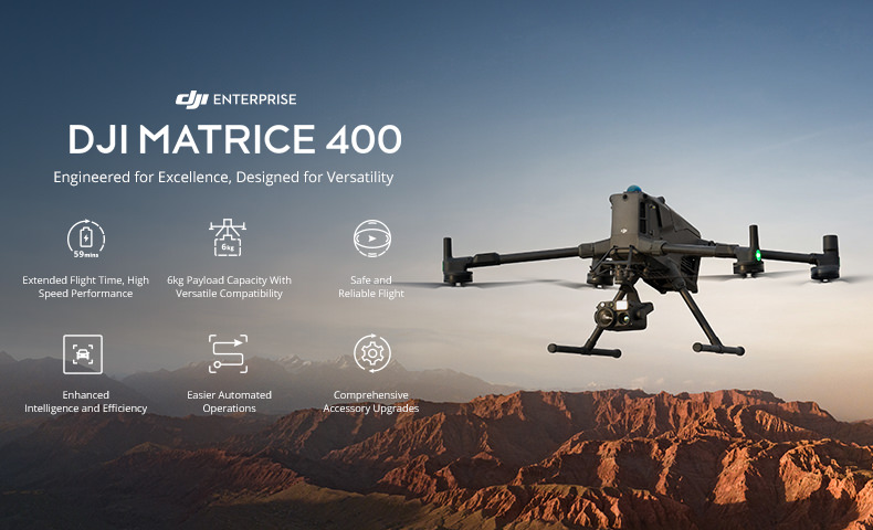
The IP55 rating means protection against dust and against water jets from any direction. DJI also warns that “the rating is not permanently effective and may decrease due to product wear and tear.” Seals age, so treat IP55 as a baseline, not a guarantee.
Flight performance
| Parameter | DJI figure | Conditions |
|---|---|---|
| Max horizontal speed | 25 m/s (about 90 km/h) | Sea level, no wind |
| Max ascent / descent speed | 10 m/s / 8 m/s | Not stated |
| Max flight time | 59 minutes | 10 m/s forward, sea level, no wind, H30T payload (10,670 g total) |
| Max hover time | 53 minutes | Sea level, no wind, H30T payload |
| Max flight distance | 49 km | 17 m/s forward, sea level, no wind, H30T payload |
| Max takeoff altitude | 7,000 m | Not stated |
| Max wind resistance | 12 m/s | During takeoff and landing |
| Max pitch angle / yaw rate | 35° / 100°/s | Not stated |
Fifty-nine minutes with a sensor on board is a very strong figure for an enterprise drone, but DJI’s method is generous: constant 10 m/s forward flight, no wind, sea level, only the Zenmuse H30T fitted, from 100% to 0% battery. Wind, temperature, a return-to-home reserve and heavier multi-gimbal setups will all cut into it. The 49 km distance figure is a theoretical one-way reference under the same conditions, not a mission profile. What it does show is enough energy for long linear inspections of pipelines, railways or power corridors without constant battery swaps.
The 7,000 m takeoff ceiling opens up high-altitude mining, infrastructure and geological work, but thin air reduces lift and payload. DJI notes that payload capacity falls with altitude; the 6 kg figure is measured at sea level on the third gimbal connector.
The 12 m/s wind rating, about 27 mph or Beaufort Force 6, applies to takeoff and landing. That is reasonable for an aircraft of this mass rather than exceptional. The -20 °C to 50 °C (-4 °F to 122 °F) operating range, without solar radiation, is more impressive, though batteries behave differently at the extremes and the heating system covered below matters in the cold.
DJI Matrice 400 payload and gimbal limits
The 6 kg maximum applies to the third gimbal connector at sea level. Each connector has its own limit:
- Single gimbal connector: up to 1,400 g. Above 950 g, gimbal damper life drops from 1,000 hours to 400.
- Dual gimbal connectors: 950 g per mount.
- Third gimbal connector: 3 kg with the quick-release port, 6 kg with screw-lock fastening.
- Zenmuse L3 gimbal connector: up to 2,100 g, with the same damper-life drop (1,000 to 400 hours) above 1,600 g.
The damper detail is easy to miss and expensive to ignore. A heavy single-gimbal payload costs 600 hours of damper life, which for a fleet flying daily means more maintenance and higher running costs than the sticker price suggests.
Supported gimbal cameras are the Zenmuse L3, H30, H30T, L2 and P1, covering LiDAR mapping (L2, L3), high-resolution photogrammetry (P1) and multisensor observation (H30, H30T). Accessories include the Zenmuse S1 spotlight, Zenmuse V1 speaker, Manifold 3 onboard computer and the DJI X-Port for custom payloads. For integrators there are E-Port V2 and SKYPORT V3 development and coaxial cable kits, and the four E-Port V2 connectors under the aircraft each supply 120 W, enough for custom sensors, onboard computers or comms relays without extra batteries. The Manifold 3 adds onboard processing during flight.
Sensing and obstacle avoidance
This is the most sophisticated system on the aircraft. It combines omnidirectional binocular vision, full-color fisheye sensors for a surround view, a horizontal rotating LiDAR, an upper 3D ToF LiDAR, a downward 3D infrared range sensor and six-direction mmWave radar.
Vision. The forward, backward and lateral sensors measure 0.4 to 21 m (lateral from 0.6 m) and detect from 0.4 to 200 m, with a 90° by 90° field of view. Downward vision measures 0.5 to 19 m with a 160° front-to-rear and 105° side-to-side view. DJI says the sensors need “delicate texture on the surface” and “adequate light”; downward sensing also needs a diffuse surface with more than 20% reflectivity and light no dimmer than a city at night. Expect unreliable vision over water, snow or featureless ground in low light.
Rotating LiDAR. Standard range is 0.5 to 100 m at 100,000 lux on a 10% reflectivity target. For power lines, DJI says it detects 21.6 mm steel-core aluminum stranded wire at 35 m, at a 30° relative tilt and 10,000 lux. It produces 520,000 points per second at 905 nm and carries a Class 1 eye-safety rating under IEC 60825-1:2014.
mmWave radar. It detects 12 mm stranded wire at 36 m and 21.6 mm wire at 50 m. DJI warns that the radar “may be unavailable or restricted in some countries or regions,” so international operators need to check.
Upper and downward sensors. The upper ToF LiDAR covers 0.5 to 25 m at night on surfaces above 10% reflectivity, with a 60° field of view; the downward infrared sensor covers 0.3 to 8 m. Together they handle ceilings and floors when flying under bridges, inside structures or beneath tree canopy.
Video transmission
O4 Enterprise Enhanced gives three channels of 1080p/30fps live view and a maximum of 40 km under FCC rules (20 km under CE, SRRC and MIC) in an open, interference-free setting. DJI’s own reference ranges, measured under FCC standards, are more useful:
- Strong interference (dense buildings, residential areas): about 1.5 to 6 km
- Medium interference (suburbs, city parks): about 6 to 15 km
- Weak interference (open, remote areas): about 15 to 40 km
DJI says these “provide no guarantee as to the actual flight distance.” The system uses 902–928 MHz, 1.430–1.444 GHz, 2.400–2.4835 GHz, 5.150–5.250 GHz and 5.725–5.850 GHz bands, with power varying by region, and an array of 8 WLAN antennas, 2 sub-2G antennas and 4 4G antennas in a 2T4R layout. It supports Dual Control Mode and two Cellular Dongle 2 links. For beyond-visual-line-of-sight work, the cellular path gives a backup that doesn’t depend on the radio link between aircraft and controller.
Batteries and charging
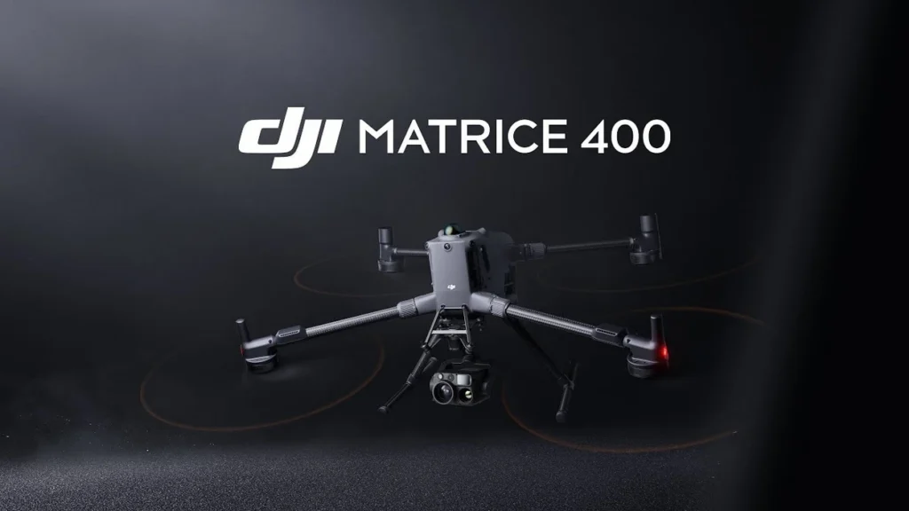
The TB100 is a 13S Li-ion pack of 20,254 mAh at 48.23 V (54.6 V maximum charge), rated at 977 Wh and 4,720 ± 20 g. It discharges at up to 4C, charges at up to 2C and is rated for 400 cycles. That cycle count deserves a line in the budget: at five flights a day on one battery, you reach it in about 80 operating days.
The BS100 battery station weighs 11.8 kg, measures 605 × 410 × 250 mm and charges three TB100s and two WB37s at once. On 220 V, a TB100 goes from 0 to 100% in 45 minutes in Fast Charging Mode or 110 minutes in Silent Mode; on 110 V, fast charging takes 70 minutes. There is also a Ready-to-Fly Mode (charges to 90%) and a Standard Mode (100%). The station works from -20 °C to 40 °C on 100–240 V AC, 50–60 Hz, 10 A, with TB100 output of about 1,185 W at 100–110 V, 1,474 W at 110–180 V and 2,184 W at 180–240 V.
Battery heating works in three modes: single battery, onboard and in the station. The TB100 also supports low-temperature self-heating while charging, which is important since charging a cold Li-ion cell can damage it. It charges between 5 °C and 45 °C and discharges between -20 °C and 75 °C.
Remote controller: DJI RC Plus 2 Enterprise Enhanced
The controller has a 7.02-inch, 1920 × 1200 touchscreen at 60fps and 1,400 nits, running Android 11. Its internal 6,500 mAh battery (7.2 V, 46.8 Wh) lasts 3.8 hours, and an optional WB37 (4,920 mAh, 7.6 V, 37 Wh) adds 3.2 hours. Charging takes 2 hours for the internal battery, or 2 hours for both when the controller is off, with PD fast charging at up to 20 V/3.25 A over USB-C.
It has 8 GB of RAM, 128 GB of storage plus microSD, Wi-Fi 6 with 2×2 MIMO at up to 1,774.5 Mbps, Bluetooth 5.2 and HDMI 1.4 out. It weighs 1.15 kg without the external battery, measures 268 × 163 × 94.5 mm and works from -20 °C to 50 °C. A sub-2G module (2T2R) and Cellular Dongle 2 support help keep the link alive where 2.4 and 5.8 GHz are crowded, such as industrial sites full of Wi-Fi.
Navigation and positioning
The GNSS receiver supports GPS, Galileo and BeiDou, plus GLONASS when the RTK module is enabled. Hover accuracy is ±0.1 m vertical and ±0.3 m horizontal with vision positioning, ±0.5 m both ways on satellites alone, and ±0.1 m with RTK. With an RTK fix, DJI quotes 1 cm + 1 ppm horizontal and 1.5 cm + 1 ppm vertical, with heading accuracy better than 2°. That removes the need for ground control points in many survey jobs. It works with the D-RTK 3 Multifunctional Station and the D-RTK 2 Mobile Station.
A built-in dual-antenna ADS-B In receiver picks up manned aircraft up to 20 km away. It gives awareness, not separation authority, but that is still valuable near airports and in controlled airspace.
FPV camera and night work
The FPV camera records 1080p at 30fps with a 150° diagonal field of view (139.6° horizontal, 95.3° vertical), and DJI rates its night vision as “Starlight Grade.” With a built-in beacon for visibility and the ADS-B receiver, the aircraft is clearly meant for night inspection, search and rescue, and police work, not only daylight jobs.
Ports
The aircraft has one USB-C debug port (USB 2.0), four E-Port V2 connectors underneath at 120 W each, and two Cellular Dongle 2 interfaces on the underside.
How it compares with the M300 and M350
The M300 RTK and M350 RTK, which improved weather sealing and battery management, carried 2.7 kg and flew for up to 55 minutes. The Matrice 400 more than doubles payload to 6 kg, adds four minutes of rated flight with a heavier load, and brings the rotating LiDAR and mmWave radar. O4 Enterprise Enhanced is also a clear step up from the previous generation’s link, with more bands and cellular backup.
Who it is for
- Utility and infrastructure inspection: wire detection by LiDAR at 35 m and radar at 50 m, plus long endurance, suit transmission line and pipeline work.
- Surveying and mapping: centimeter RTK, the L2/L3 LiDAR and P1 photogrammetry payloads, and 59-minute endurance for large areas.
- Public safety and search and rescue: the H30T, starlight-grade FPV camera, beacon, ADS-B In and dual-gimbal capacity for thermal and optical sensors.
- Industrial and research work: E-Port V2, Manifold 3 and high payload for custom sensors.
- Offshore and coastal work: IP55, 12 m/s wind resistance and long endurance.
It is not for casual or recreational flying, or for operators without proper licensing and training. Battery management, payload configuration, compliance and maintenance are a step up from any consumer or prosumer drone.
Limits to plan around
- Damper life drops sharply above the gimbal weight thresholds, and the 400-cycle battery rating is a recurring cost.
- Vision sensing can be unreliable over water, snow, sand or in real darkness, so keep manual control ready.
- The mmWave radar is restricted in some regions, 5.2 GHz is indoor-only in some countries and 5.8 GHz is banned in others. Check each country you work in.
- At 9.7 kg plus a hard case, it is easy to deploy from a vehicle and a real burden if you have to hike to the launch site.
Where the Matrice 400 stands in October 2026
Two things have changed since this page was first written. First, the FCC’s 22 December 2025 Covered List decision stopped new DJI equipment authorizations in the US. The Matrice 400 was authorized before then (FCC ID SS3-M4002412), so it can still be imported, sold and flown, and US enterprise dealers stock it. What it cannot get is a new authorization for a revised model. Many US public-safety agencies can’t buy it anyway, because of state laws in Florida, Arkansas, Tennessee and elsewhere, or federal grant terms that exclude Covered List equipment. The US drone ban checker tracks the federal position model by model, and the US drone ban hub explains the state layer.
Second, the Department of Homeland Security published its SAVER comparative assessment of Blue UAS aircraft in September 2026. The Matrice 400 was not tested, but its smaller siblings were: the Matrice 4T and Matrice 30T flew alongside five American-made Blue UAS at Hudson Yards in Manhattan, and the DJI scores were left out of the public report. Three of the five Blue aircraft could not hold position in the urban canyon. If you are weighing the Matrice 400 against a domestic heavy-lift alternative, that report is the only independent, same-course evidence on how DJI’s enterprise sensing and link stack behaves in a dense city. Read it before deciding.
Against the much smaller Matrice 4T, the difference is payload: the 4T carries 200 g of accessories on a 1.2 kg airframe, the 400 carries 6 kg on 9.7 kg. The Matrice 4T vs 4E and Skydio X10 vs Matrice 4T comparisons cover the compact end.
My assessment: for an operator already in the DJI enterprise ecosystem and free to buy it, the Matrice 400 is the obvious upgrade, and its wire-detecting LiDAR and radar are the features competitors will find hardest to match. The 350 RTK remains capable and is cheaper second-hand. For a US public agency, the spec sheet is the easy part; check your state law and grant terms first, because they decide whether this aircraft is an option at all.
Enterprise drones listed on Amazon US
Mapping-focused enterprise drone listed on Amazon US.
DJI Matrice 4TD
Thermal, wide and tele cameras; the dock-ready Matrice 4 variant, with RC Plus 2 Enterprise.
As an Amazon Associate, Drone Ranker earns from qualifying purchases. We do not quote prices because Amazon’s change by the hour.
First published June 2026; substantially revised 5 October 2026.
The Friday Brief
One email a week on what changed in drones
FCC and FAA rule changes, DJI leaks checked against filings, and the week’s new comparisons. Every Friday, nothing else.
Free. Unsubscribe in one click. Sent with Kit; see our privacy policy.
Follow us on Google too: add Drone Ranker as a preferred source →
Continue Reading
All News